Italy is full of such diverse landscapes. Full of so many breathetaking an incredible hikes Hiking around italy has so much to offer. Here is our guide to the best hikes in Italy.
Cala Luna, Sardinia Hike
Claudia Tavani from Strictly Sardinia
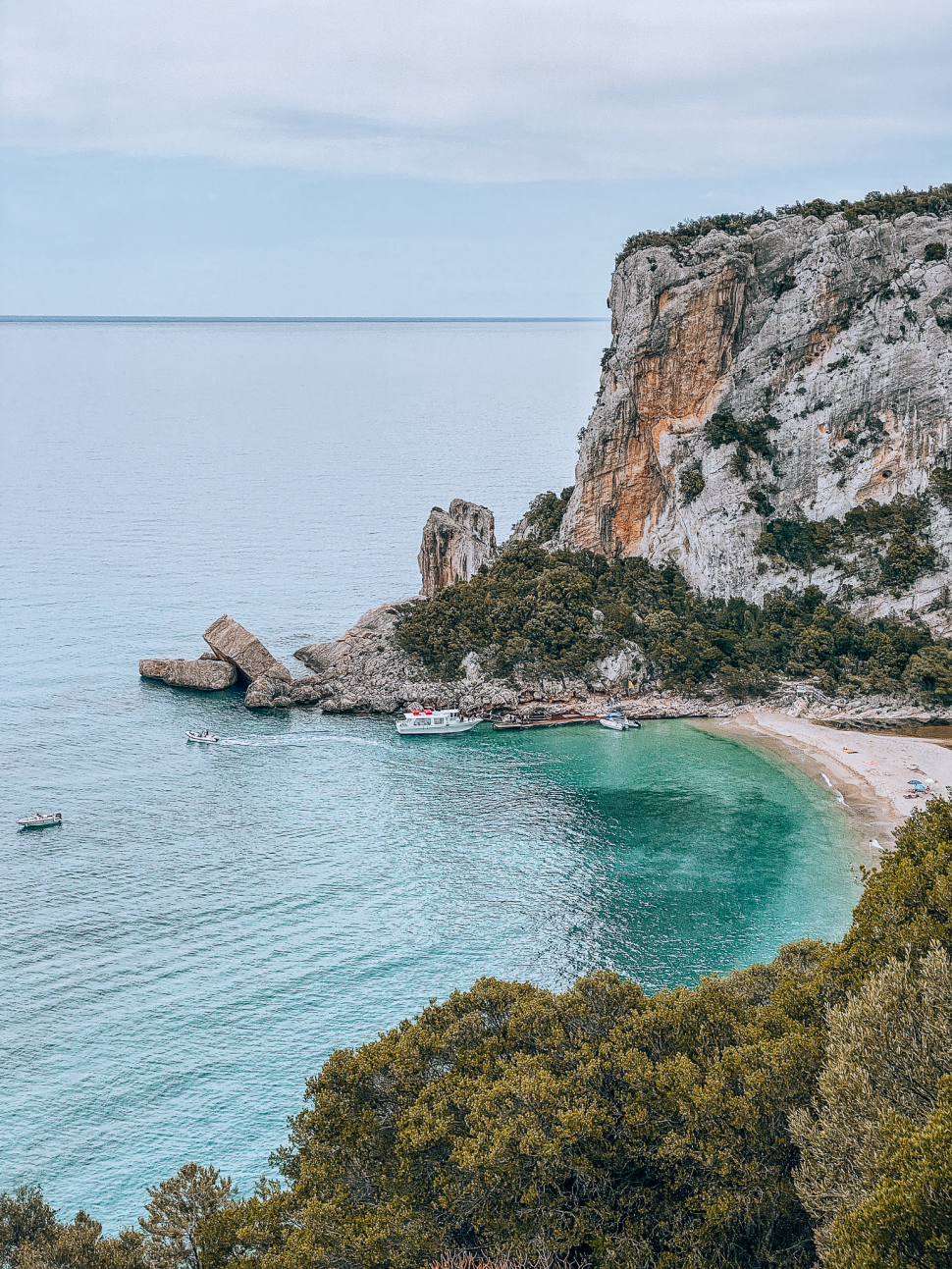
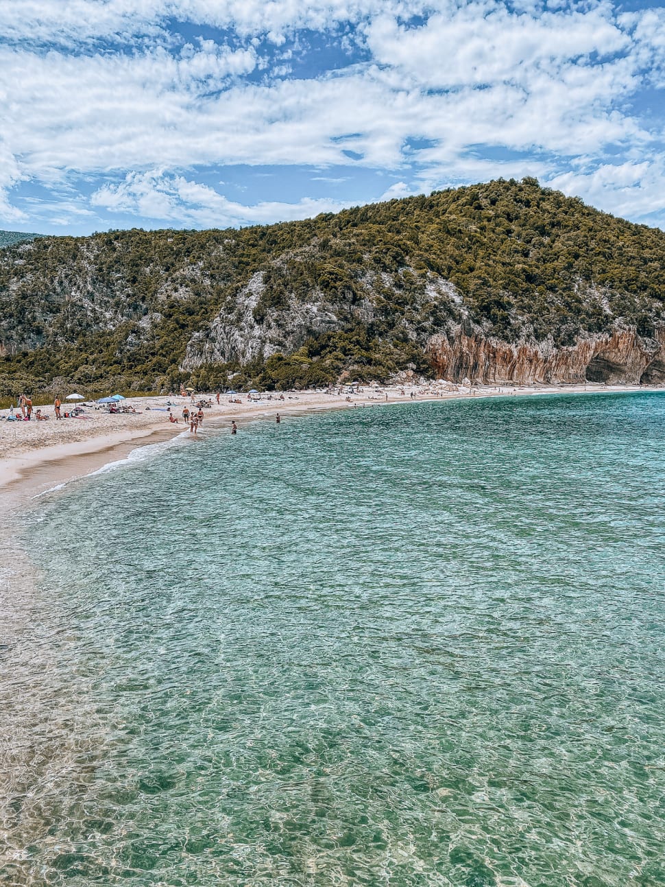
Cala Luna is a small cove in the Gulf of Orosei. It sits on the eastern coast of Sardinia, and is thought to be one of the most beautiful beaches in the Mediterranean. Part of its charm is due to its isolation: no roads lead directly to the beach. The only way of getting there is by boat from Cala Gonone or on a hike.
Two trails lead to Cala Luna beach. The best one departs from Cala Fuili, another gorgeous cove just outside of Cala Gonone.
This hike is of moderate difficulty and around 16 km there and back. The trail is easy to follow and will guide you through a thick Mediterranean forest with several viewpoints with impressive coastal views. You will occasionally have to go over large boulders throughout the hike, but the ascent is minimal. Along the walk you won’t find any services along the way, nor at the beach. Make sure to bring whatever you may need for the day in terms of food and water.
Late spring provides the best time to take on this hike. It is warm enough to enjoy the beach fully, and it’s possible to take a dip in the icy waters.
On the beach’s left-hand side, you will find a few beautiful caves that provide shelter from the sun and the heat.
On the way back, you have two options. Firstly, you have the option of walking back to Cala Fuili. Secondly you can hop on one of the boats departing from Cala Luna. Although the second option is only available when in season.
Cinque Terre Blue Trail
Contributed by Renee of Dream Plan Experience
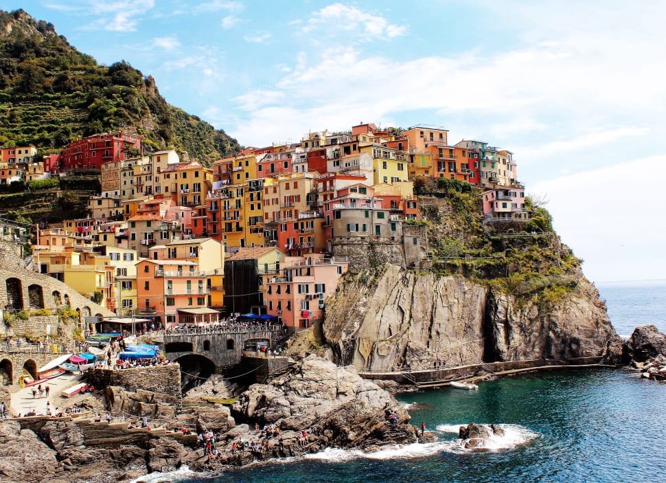
The five incredibly scenic villages of Cinque Terre sit on the rugged cliffs above the sparkling coastline. These towns are easily recognizable with their pretty pastel-coloured buildings stacked high on top of each other. There are three options to explore this national park and UNESCO World Heritage site: boat, train, or hike.
There is an 11 km Blue Trail connecting all five villages from Riomaggiore to Monterosso al Mare. The easy 1.5 km from Riomaggiore to Manarola is known as Lover’s Lane or Via dell’Amore. Click here to see the location of the trailhead on Google maps. Then from Manarola to Corniglia is another easy trail at 3 km. The hike from Corniglia to Vernazza is a moderate trail at 4 km. Lastly, from Vernazza to Monterosso is a moderate trail of 3.5 km. It takes about 5 hours to hike the entire distance, not counting the time to explore each village.
To hike the trail, you need to purchase a ticket. Consider buying the Treno Cinque Terre, allowing unlimited trips on the train and trails for a full day. Trails can sometimes be closed due to the frequency of landslides of the steeply sloping land. Each village will offer you lots of food, water, and gelato choices. There are also public water fountains in each town to refill your water bottle.
Volastra to Corniglia
by Anne Betts from Packing Light Travel
For spectacular views of the Ligurian coast, hike through vineyards high above Manarola and Corniglia, two of the five Cinque Terre villages. Start in the hilltop village of Volastra and hike the 3.7 kilometres (2.3 miles) to Corniglia. Hiking in this direction means that most of the route is either flat or downhill. Another option is to start in Manarola and hike uphill to join the trail in Volastra. However, it’s a steep climb involving 1200 steps. The Volastra to Corniglia hike is perfect for leisure hikers.
Allocate at least a couple of hours, stopping frequently to soak up the views. Another interesting feature of the hike is that the vineyards are a testament to the back-breaking work involved in creating and maintaining them. You’ll pause in wonderment at the stone terraces. It is easy to visualize how generations of workers have managed the vineyards and harvested grapes from the narrow hillside paths.
Volastra is a small village with a population of 200. There is a minimart but it would be wise to pack your own drinks.
It can be very hot during the summer months, so start early or plan an early evening hike. In the spring, the coastal trails may be closed due to heavy rains, so the Volastra to Corniglia hike offers a viable alternative. In the fall, the vines are covered in fruit that’s harvested between August and November.
Stromboli Hike
By Emily from Wander-Lush
Hiking to the Stromboli volcano crater is one of the more adventurous things to do when visiting the Aeolian Islands. Stromboli is one of Italy’s three active volcanoes and the only volcano in Europe that’s caught in a permanent state of eruption. The guarantee of seeing fireworks-like lava explosions and plumes of violet smoke up close makes this hike one-of-a-kind.
Because of the risk involved (large explosions are not uncommon), the hike is strictly controlled. The only way to summit the crater is with a guide. Groups of 20 or so people depart from outside Chiesa di San Vincenzo Ferreri in the late afternoon. This allows you to make it to the crater in time for sunset. The hike takes around 5-6 hours in total (including plenty of time at the top for photos). Because of the terrain and the elevation, it requires a moderate-high level of fitness.
There are no shops on the way, so it’s essential to carry water and snacks. If you don’t have gear with you, you can hire boots, trekking poles and flashlights from the small shops in town. Helmets and headlamps are provided as part of the tour. Reservations are mandatory, and in the summer peak season months, you should book as far in advance as possible. By the time the trek finishes, night has fallen. For this reason it is best to stay on the island in one of the small hotels or guesthouses. The following day you can wander around the artist’s shops or swim on the black sand beaches.
Stromboli is one of the seven islands that makes up the archipelago off Sicily’s western coast. It can be accessed by hydrofoil from Milazzo or Messina on the mainland.
Path of the Gods
By Us!
The Path of the Gods provides some of the best view points across the whole of the Amalfi Coast. This trail runs from Bomberano to Nocelle and takes around 2-3 hours.
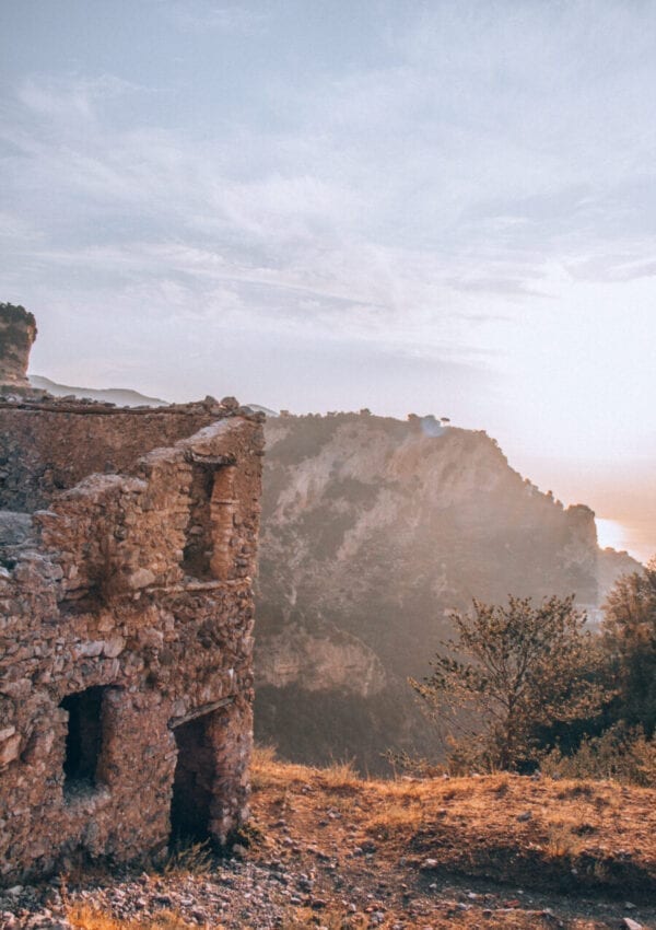
The hike takes you through ancient ruins, dramatic view points and so much more.
At the end of the hike there is a beautiful drink stand that offers fresh Lemon and Orange, called Lemon point. It is a great place to go and get a refreshing drink after your long hike.
Read our complete guide to the Path of the Gods to discover more about this amazing hike.
Hike of the 5 waterfalls of Cerveteri
By Lisa of Travel Connect Experience
Not only nature lovers will find delight in hiking in Italy, but also archaeology enthusiasts. Regarding the immense architectural heritage that has come down from the Etruscan civilization, many sites can only be visited through nature walks. Trees have often grown through the stone, making the archaeological ruins even more impressive, as in the case of the Etruscan Necropolis of Cerveteri. Cerveteri is a small city about 40 kilometers from Rome. It has been inhabited since at least the ninth century BC and included in the area also called “Tuscia“. It is named this precisely because of the presence of extensive archaeological evidence.
The Etruscans built the largest necropolis of the Mediterranean. Complete with a “Way of the Underworld” dug through a wall of stone and equipped with hundreds of funeral rooms carved into the rock on both sides. All of these can be visited free of charge and with flashlight hat. From the Way of the Underworld starts one of the most popular hikes near Rome, ring-shaped, 18 km-long and medium difficulty. The walk continues inside a lush gorge where 5 waterfalls are to be discovered until arriving near the village of Castel Giuliano.
The most spectacular waterfalls are the last two, those named “Dell’Ospedaletto” and “Della Mola”, at the latter you can take a refreshing bath.
It is recommended to do this walk in the period from May to November, avoiding the hottest months of July and August. It is necessary to bring something to eat, a hat and at least 1.5 liters of water.
There is a small ditch to cross, so it is useful to wear waterproof hiking shoes or gaiters.
Sorapis Hike
By Arzo Travels “Eat well, dress up, and travel!”
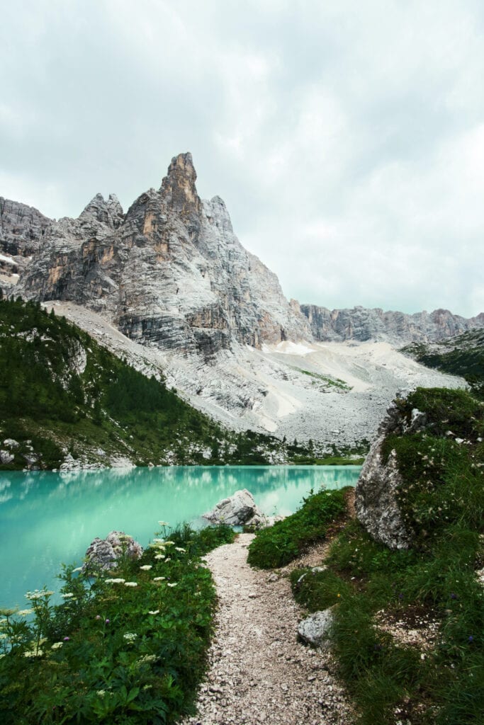
In Italy, a must-do hike is the Lake Sorapis hike. The hike itself is not the most scenic or special but Lake Sorapis itself makes the hike a must-do. Lake Sorapis is located in the Dolomites, located in the province of Belluno in the Veneto region. It is about 1,900 meters above sea level, and you can get there only by hiking. This is probably why it is busy yet not as popular as more accessible lakes in the Dolomites. There are two main hiking paths – none of them is easy. They are both marked as medium difficulty. You should be surefooted and wear proper hiking boots.
The easier hike takes about 4-5 hours in total and includes uphill- and downhill hiking. Start at Passo Tre Croci and head towards the lake via path 215. There are narrow ledges with a handrail on the side. You should be surefooted and wear proper hiking boots. There is a Refugio near the lake but it is not always open, so bring enough snacks and drinks.
While there are more scenic hikes, seeing Lake di Sorapis is worth it! The lake has incredible colour. The lake is small and the water is cold, so there is not loads to do around Lake di Sorapis. Bring a book, a blanket, and just enjoy the scenery.
To get back either just walk the same path or do a circular hike (not really recommended though).


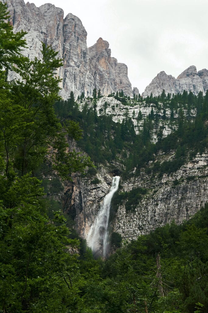
Sorapis Hike, waterfall and mountain range. The Dolomites. Best Hikes in Italy
The Cadini di Misurina hike
By Krisztina from She Wanders Abroad
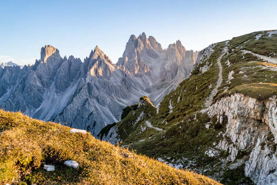
The name Cadini di Misurina might not sound familiar to you, but if you have seen photos from the Dolomites, you will have come across this incredible viewpoint. The Cadini di Misurina hike is a really short, but insanely scenic route so it’s totally worth adding it to your Dolomites hiking list.
The starting point of the hike is Rifugio Auronzo, where the famous Tre Cime di Lavaredo hike also starts. You can get to Rifugio Auronzo via public transportation or by driving up in your own car. Although if you chose to drive, you need to pay 30 EUR for the road usage. You can also decide to hike up to Rifugio Aurozno from Lake Antorno but be prepared for a very steep hike.
After you arrive at Rifugio Auronzo, you need to find trail number 117. This is the trail that goes in the direction of the sharp pinnacles of Cadini di Misurina. Keep in mind that trail number 101 also starts here, but this is the trail for the Tre Cime di Lavaredo loop hike. You will need to hike in the opposite direction if you want to find the famous Cadini di Misurina viewpoint.
The route is quite short (around 2 km in length). You will get to the viewpoint in around 35-45 minutes, depending on your fitness level. The hike itself is easy, although you will have to face some narrow paths with steep drop-offs. Because of this, It is not suitable for people with a fear of heights. But if you manage to get there, you will be rewarded with one of the most scenic views you’ll ever see!
Il Sentiero delle Cipolliane in Puglia hike
By Maria & Katerina of It’s All Trip To Me
Southern Italy is filled with treasures and the irresistibly charming and indisputably authentic region of Puglia, even more so. One of the best ways to appreciate Puglia’s unique character is to walk around its natural wonders.
Il Sentiero Delle Cipolliane is an amazing hiking trail that combines stunning scenery with rare historical findings. It’s a coastal path dotted with impressive rock formations and ancient caves with remnants that date back to the Upper Paleolithic Era.
All along this trail, the views of the Adriatic Sea are breathtaking. However, the best viewpoints are the famous caves, the Grotte Cipolliane, and the Ciolo area with the gorgeous fiord and the dramatic bridge.
Il Sentiero Delle Cipolliane starts from Marina di Novagie, a quaint seaside town, and ends in Ciolo, near the bridge. The trail runs along the cliff that overlooks the Adriatic Sea for as far as the eye can see. The total length of the path is 2.2km. It’s an easy to moderate route and you can complete it in about one hour and 45 minutes.
There are places to get food and drinks at the start and the end of the trail. The path is clearly signposted. A small detour along the trail will take you to the impressive Cipolliane caves before you make your way towards the end of the trail in Ciolo.
The ultimate highlight of the Ciolo area is the fantastic bridge which enjoys jaw-dropping views of the sea and the surrounding nature. On a warm day, the best way to finish a day spent hiking is a dive in the emerald waters of the Ciolo inlet.

Mount Solerno Capri
Mount Solerno on the island of Capri offers breathtaking views over the Capri landscape. This peak is the highest point of Capri. It is really easy to get to. From Capri port itself get the bus to Ana Capri. Once in Ana Capri, you can hike up to the mountain top, or get the chairlift up and hike down!
Summary of hikes around Italy
We hoped you enjoyed our guide to some of the best hikes in Italy.
Whats next?
Check out our other Italy posts!

